‘The sea around Scilly is shallow and rocky, as many an ancient mariner has found to his peril. Apart from the deep channel of St Mary’s Sound, between St Agnes and St Mary’s, the water here is no deeper than 13 metres. The islands are often shrouded in fog, and more than 600 ships are known to have been wrecked on the Scilly rocks, with probably many more unknown. Much of the sea bed to the west of Bryher was last charted with a plumb line prior to 1904, so if boating on that side, be aware that your charts and GPS may not show every single rock.
Three wrecks around Scilly have statutory protection, the most famous of which is the Association, which went down in 1707 [with the loss of some 1,400 lives] in what is still considered to be one of the worst maritime disasters in British Royal Naval history. You can see many of the figureheads from the wrecks in Valhalla, in Tresco Abbey gardens.
You can certainly swim in the sea off Scilly. Many people bring a wetsuit as it’s generally a little bit too cold for all but the most hardy (and children!) to spend much time in the water. If you take a boat out and get into the water a little way offshore, you may attract the odd curious seal. You can hire a boat on Bryher, from Bennett’s Boatyard or from Isles of Scilly Boathire. If you’re not sure about being your own skipper, you can book a trip on someone else’s boat: there are notices on St Mary’s quay every day to tell you about boats going out to the off-islands to look for wildlife and enjoy the view.
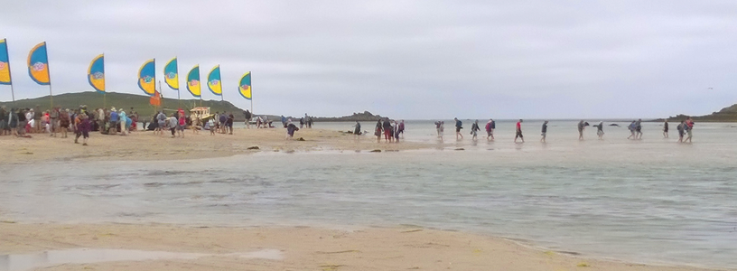
The tides dominate life on Bryher, as at times, the sea is very shallow and local boats know to negotiate the shallow channels carefully due to the ever-shifting sand banks. A few times a year, you can walk from Bryher to Tresco or Samson (although, for the latter, you have to be quick as the window of opportunity is short). Please seek advice from the Tresco Estate office before attempting any crossings on foot, as tides and weather varies.
Tide tables are published online, and there are lots of good apps available now for your smartphone so that you can keep an eye on the height of the tide and the state of the sea. Boat times vary with the tide and the expected demand, but you will find the times of boats chalked up in many places on the island, including the board on the side of Bank Cottage.

